CAD02: SALTWATCH
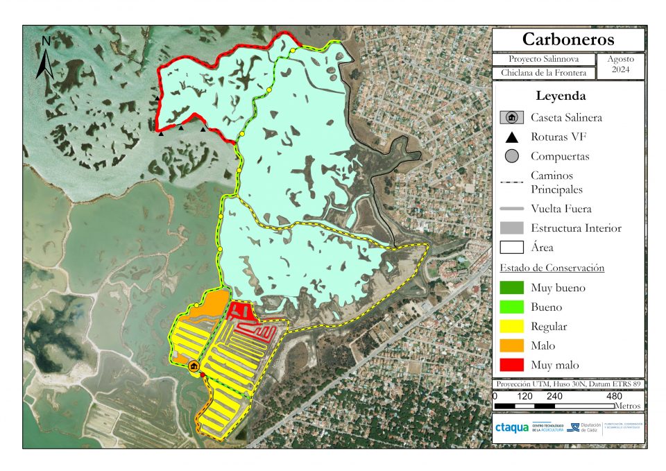
- Conservation status of the Carboneros Saltmarsh in Chiclana, Cádiz (Credits: SALINNOVA Project)
Cádiz
- Organisation
- Fundación Centro Tecnológico de la Acuicultura de Andalucía (CTAQUA)
- Sergio Aranda
This challenge is to use predictive analysis techniques (mathematical modeling, machine learning, etc.) to develop a GIS-type digital tool to identify saltmarshes at risk of deterioration or disappearance, based on the loss of activity or use, changes in functional structures in recent years, proximity to urbanizations, flood maps, etc. The result is intended to be a digital tool that quickly visualizes the risk of abandonment or deterioration of saltmarshes, as well as the risk of flooding in urban areas, in order to prioritize policies for the restoration or reactivation.
- What the challenge owner would like to develop over 48h
- Geographical Information System
- Which skills the challenge owner is looking for
- Machine learning, statistical analysis, data management, GIS software management, spatial and raster data processing, multi-scale and multi-criteria analysis, satellite image interpretation, use of access platforms, dashboard development, environmental management, etc.


