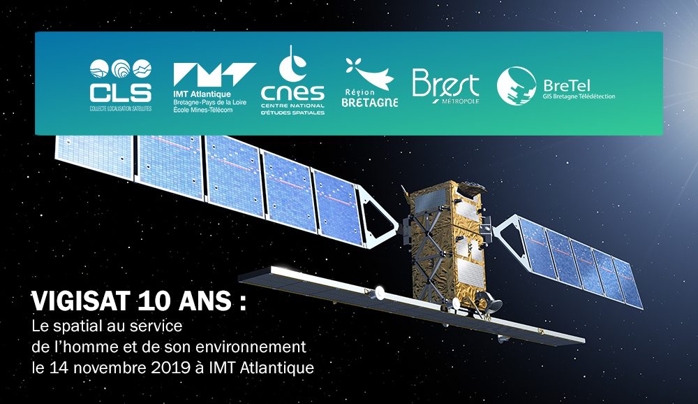
Vigisat celebrates its 10th anniversary
- Vigisat stakeholders gathered on November 14 at IMT Atlantic to recall the main stages of this project
VIGISAT is a satellite image acquisition station owned and operated by CLS, a subsidiary of CNES, backed by an ambitious scientific project led by IMT Atlantique. This project, structured around a scientific interest group, the GIS BreTel, offers privileged access to spatial data to a network of innovative actors. VIGISAT is forward-looking and innovative and would not have been possible without the support of the Brittany Region, Brest Metropole and Europe.
On November 14, the initiators and actors of this project reviewed 10 years of successful public/private partnership in the service of man and his environment.
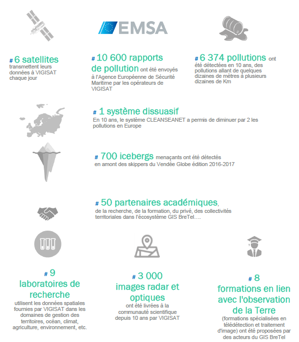
Reduction by 2 of hydrocarbon pollution in European waters, fight against illegal trafficking (illegal fishing, drugs, illegal immigrants), better understanding of extreme weather phenomena (hurricanes), detection of icebergs threatening the largest offshore races (Atlantic Brest, Vendée Globe, Barcelona, World Race, etc.).) but also the creation of a platform for access to satellite imagery data for research, training and business (land management, ocean, climate, agriculture, environment): this is what the VIGISAT project has enabled over the past 10 years!
VIGISAT, an operational infrastructure to monitor maritime situations
Ten years ago, CLS, a subsidiary of CNES, in partnership with IMT Atlantique and with the support of the Brittany Region, Brest Metropole and Europe, set up VIGISAT, the first and only civilian station for receiving high-resolution radar satellite images on the Brest-Iroise Technopôle site.
VIGISAT represents the best that public/private partnership can offer in terms of success strategy! The figures are there to prove it (see next page), VIGISAT is a great success both in terms of maritime surveillance (radar, optical and UAV imagery), Earth observation and scientific advances.
Thanks to CLS's operational and real-time capabilities, VIGISAT has joined the very closed circle of European maritime satellite surveillance. Today, VIGISAT has made it possible to contribute to a twofold reduction in oil pollution in our European waters, to combat illegal fishing, illegal trafficking, to better understand extreme weather phenomena (hurricanes) and to detect icebergs threatening the largest offshore races (Atlantic Brest, Vendée Globe, Barcelona, World Race, etc.).
VIGISAT, meeting the needs of Earth observation in Brittany
VIGISAT is also a scientific project, led by IMT Atlantique, to provide a platform for access to satellite imagery data for research and training in Brittany.
This project is led by the Groupement d'Intérêt Scientifique (GIS) Bretagne Télédétection, which brings together 10 academic and public stakeholders from the Breton scientific community. This project will have enabled its members to develop new applications through innovative data processing methods (AI, Big Data, etc.....) in many fields of applications and uses such as the environment, climate, agriculture, maritime and coastal activities.The future of space also lies in Brittany
Brittany has a strong scientific ecosystem and sees the emergence of many companies in the field of space technologies and their applications, the Brittany Region and Brest metropolitan area have been able to support the development of this sector for more than 10 years.
In order to continue and strengthen this dynamic, the CNES (Centre national d'Etudes Spatiales) and the Brittany Region signed a framework partnership agreement on the occasion of this anniversary date.
This agreement aims to:
- Support and strengthen the research, expertise, training and outreach capacities of laboratories, public institutions and economic actors in Brittany in terms of innovative applications based on spatial data and solutions.
- Develop observation and analysis systems for the consolidation of local expertise in the field of space technologies and their applications.
- Support the economic development of the space technology sector and its applications in the region.
- Support the dissemination of space technologies and their applications within thematic areas (maritime, spatial planning, agriculture, energy, environment, mobility, cyber security, Internet of things, etc.).
- Support public institutions in the use of space applications for land management, environmental preservation and adaptation to climate change.
- Strengthen national, European and international positioning.
A platform on the Marine research infrastructures and facilities portal
You can find two Vigisat features on the portal:
- the scientific project carried out by the GIS BreTel,
- the reception and analysis station operated by CLS.
- En savoir Plus
- Keywords : <a href="News_Infrastructures-3046-0-0-0.html?b3338_TAGs_57=505">agreement</a>, <a href="News_Infrastructures-3046-0-0-0.html?b3338_TAGs_57=506">campusinfras</a>, <a href="News_Infrastructures-3046-0-0-0.html?b3338_TAGs_57=507">CLS</a>, <a href="News_Infrastructures-3046-0-0-0.html?b3338_TAGs_57=508">convention</a>, <a href="News_Infrastructures-3046-0-0-0.html?b3338_TAGs_57=509">entreprise</a>, <a href="News_Infrastructures-3046-0-0-0.html?b3338_TAGs_57=510">infrastructure</a>, <a href="News_Infrastructures-3046-0-0-0.html?b3338_TAGs_57=453">observation</a>, <a href="News_Infrastructures-3046-0-0-0.html?b3338_TAGs_57=446">recherche</a>, <a href="News_Infrastructures-3046-0-0-0.html?b3338_TAGs_57=511">research</a>, <a href="News_Infrastructures-3046-0-0-0.html?b3338_TAGs_57=512">satellite</a>, <a href="News_Infrastructures-3046-0-0-0.html?b3338_TAGs_57=513">Vigisat</a>
- Published on 20/11/2019

