Ocean Hackathon 2020®: an ocean of data!
- Research organisations and administrations collect large volumes of data to improve knowledge and support public policies. Ocean Hackathon® is an opportunity to explore the great potential of this data to address social, economic and environmental challenges.
Focus on the data made available this year!
Twelve cities around the world are organising this year's Ocean Hackathon® simultaneously. In order to enrich the demonstrators and allow the teams to develop their challenges, many partners have been mobilised.
French data providers
As Ocean Hackathon® ambassadors and data providers, these organisations make their data and coaches available to support the teams throughout the weekend!

European and international portals
In 2020, the international dimension of Ocean Hackathon® is even stronger! In order to make data available to all the teams, the emphasis is put on large scale data, whether satellite data or data from oceanographic campaigns and numerical modelling.
Participants will therefore be able to access the following portals:

The BreTel GIS, the Morespace booster and ESA BIC Nord France have mobilised to provide easy access to satellite images for the 2020 edition.
Maritime trafficAnother novelty is that ship positioning data (AIS system) will be available along the French metropolitan coasts and all over the world thanks to the following actors:


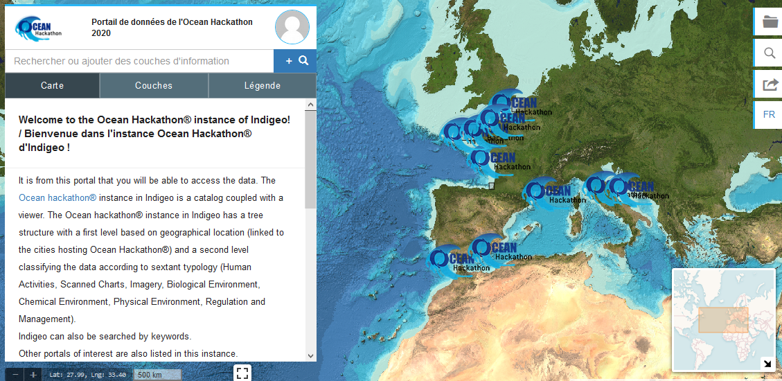
To help participants to find their way around, the Indigéo portal!For 4 years now, the LETG has been providing participants with a dedicated Ocean Hackathon® instance in the Indigéo portal. They will thus be able to search for data, visualise it and access it!
- En savoir Plus
- Keywords : <a href="News-3537-0-0-0.html?b3338_TAGs_57=618">data</a>, <a href="News-3537-0-0-0.html?b3338_TAGs_57=619">données</a>, <a href="News-3537-0-0-0.html?b3338_TAGs_57=231">innovation</a>, <a href="News-3537-0-0-0.html?b3338_TAGs_57=144">Ocean Hackathon</a>
- Published on 10/01/2020

